Search St. Cloud Deed Records
St. Cloud deed records are filed across three counties - Stearns, Benton, and Sherburne - because the city spans county boundaries. Stearns County holds the largest share of St. Cloud parcels. Each county recorder maintains its own set of recorded instruments for property within its boundaries, so the right place to search depends on where in St. Cloud the property is located. This page explains how all three systems work and what city and GIS tools help with St. Cloud property research.
St. Cloud Deed Records Overview
County Recorders for St. Cloud Deeds
Because St. Cloud straddles three county lines, the first step in any deed search is confirming which county the parcel falls in. The Stearns County Recorder handles the majority of St. Cloud properties. Stearns County Recording Services are available at stearnscountymn.gov. Stearns County also provides online deed access through LandShark, which lets you search by address, owner, parcel ID, document number, or legal description.
Properties in the eastern part of St. Cloud may fall in Benton County. The Benton County Treasurer's office can be reached at 320-968-5006 for questions about Benton County parcels. Northern St. Cloud parcels may be in Sherburne County, reachable at 763-765-4350. If you are unsure which county covers a specific St. Cloud address, start with the city GIS or Stearns County GIS portal to identify the parcel and confirm the county.
Under Minnesota Statute 507.34, a deed is void against a later buyer who records without notice. St. Cloud buyers must record in the correct county. Recording a deed in the wrong county does not protect ownership. The base recording fee is $46. Deed tax under Minn. Stat. 287.21 is 0.33% of the net consideration. Tax certification under Minn. Stat. 272.12 must be completed before recording. Documents must comply with Minn. Stat. 507.093.
Stearns County GIS and LandShark
The Stearns County GIS portal provides an interactive map for all parcels within Stearns County, including the main portions of St. Cloud. You can search by address, owner name, or parcel ID. The GIS displays parcel boundaries, ownership data, and property details that help confirm which county a parcel falls in before running a deed search.
The image below shows the Stearns County GIS hub, which is the primary map tool for St. Cloud deed research involving Stearns County parcels.
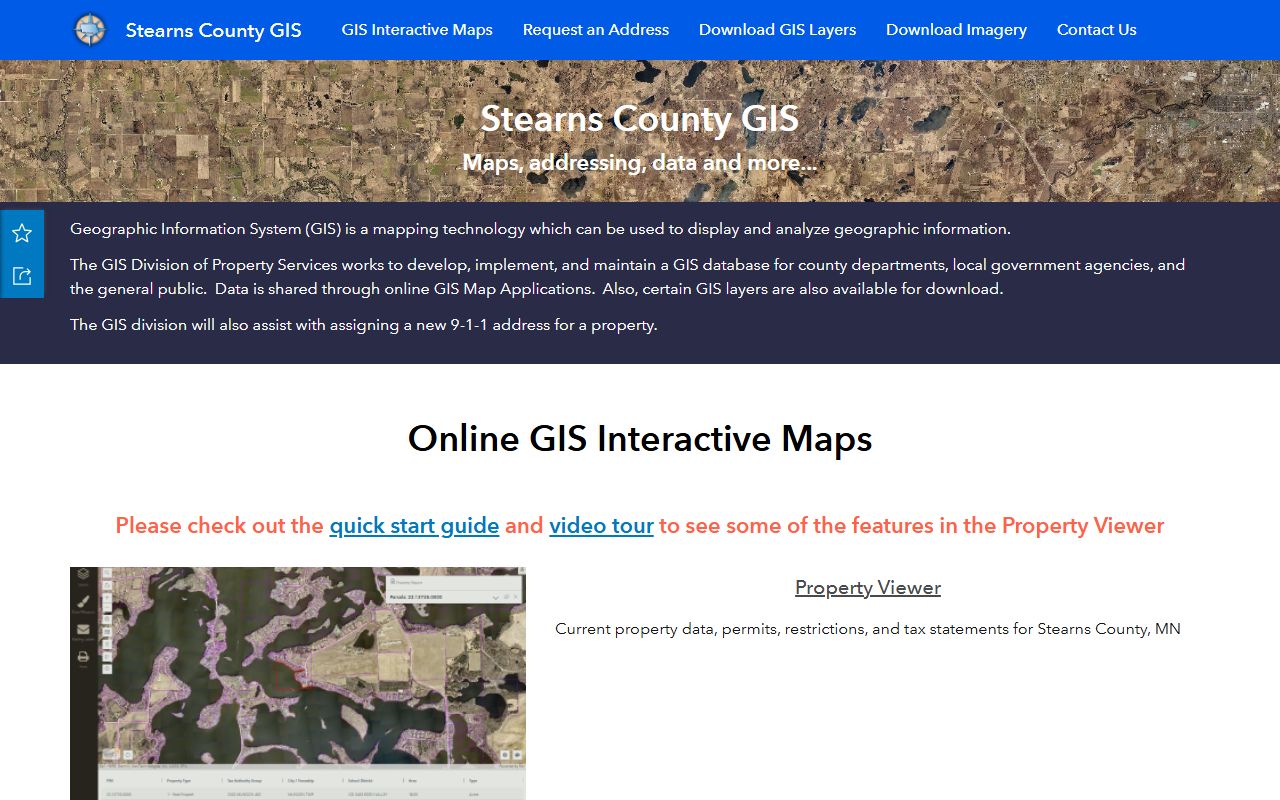
The Stearns County GIS links to parcel data and ownership records that feed into the LandShark document search system for recorded instruments.
LandShark is Stearns County's online deed search platform. It provides access to recorded warranty deeds, quitclaim deeds, mortgages, and other title instruments for all Stearns County parcels, including those in St. Cloud. You can log in through the LandShark portal to search and view document images.
Note: For Benton and Sherburne County parcels within St. Cloud, contact those county recorders directly for online search options.
St. Cloud City Assessor and City Resources
The St. Cloud City Assessor is located at 1201 7th Street South, St. Cloud, MN 56301. Phone: 320-255-7203. Email: assessor@ci.stcloud.mn.us. The assessor maintains valuation records for all city parcels and can help confirm which parcels fall within city limits and which county they are in. Assessment records show ownership, property classification, and estimated market value, all relevant to deed tax calculations.
The image below shows the St. Cloud city website, which provides links to city departments, assessor information, and planning resources that support property research.
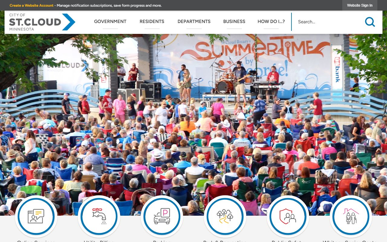
The city website connects to assessing, planning, and permit resources that are all useful when researching deed records for St. Cloud properties.
St. Cloud has a city GIS system, known as SCGIS, which was launched in August 2009. SCGIS provides property record cards online and includes a historic district layer that can be relevant when researching older properties in the downtown core. The GIS shows parcel boundaries, ownership, and land use classifications for all city parcels across all three counties.
Deed Types Used in St. Cloud
Warranty deeds and quitclaim deeds are the most common deed types in St. Cloud. Both are governed by Minn. Stat. 507.07. A warranty deed includes covenants that the seller holds good title. A quitclaim deed passes the grantor's current interest without any warranty. Both require notarization before recording.
For homestead property owned by a married person, both spouses must sign under Minn. Stat. 507.02. Transfer-on-death deeds are available under Minn. Stat. 507.071 for St. Cloud owners who want to avoid probate. TODDs must be recorded before death to be effective. St. Cloud parcels on the Torrens system are governed by Minn. Stat. ch. 508 and must be processed through the appropriate county's Examiner of Titles.
Recording in the Right County Matters
Because St. Cloud spans three counties, recording in the correct county is essential. Under Minn. Stat. 507.34, a deed recorded in the wrong county does not provide the legal protection that recording is meant to give. A buyer who records in Stearns County for a parcel that is actually in Benton County has not protected their ownership. Always confirm the parcel's county before recording a deed.
The SCGIS system and the Stearns County GIS portal are good tools for confirming county boundaries for any St. Cloud address. Once you know the right county, record with that county's recorder without delay. Recording is the legal act that creates publicly enforceable ownership and protects against later claims.
Nearby Cities
Deed records for these nearby communities are also filed with their respective county recorders.